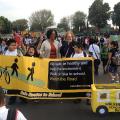
 Happy Walktober! The City of Los Angeles is in the process of creating its citywide Safe Routes to School Strategic Plan. A Happy Walktober indeed! This endeavor is now beginning with the recent start of the City’s first ever pedestrian coordinators, Margot Ocanas and Valerie Watson, who were hired to help make Los Angeles a more walkable city and to develop a City-wide Safe Routes to School Strategic Plan. This project is in its beginning stages and will take at least a year. It is a great time for stakeholders and interested residents to get involved.
When we look at Los Angeles, there are close to 1,000 schools, and a population of 3.8 million people and covering 500 square miles. This map shows that seven cities—San Francisco, Boston, Minneapolis, Pittsburgh, Milwaukee, St. Louis and Cleveland—plus the island of Manhattan, fit within Los Angeles city limits--a great reminder of the vastness of Los Angeles city. 
It is a huge and wonderful city with great need for improved pedestrian and bicycle policies and investments. A City-wide Safe Routes to School Strategic Plan will allow the City to prioritize and methodically address making it safer for students and their families to walk and/or bicycle to school, as well as ensure Safe Routes to School funds succeed in Los Angeles, leverage additional resources, and achieve regional and state transportation and health goals. As one of our great transportation thinkers Enrique Penalosa says, it’s not about the funding but about the priorities.
Much of this concept is modeled after the work done in New York City in 2003 when they developed their Citywide Safe Routes to School Plan. One of the primary factors in identifying areas of high need will be collision data as mapped by the State of California in the tool, Transportation Injury Mapping System (TIMS).
Focused efforts on this idea started in the Spring 2010, and since then, a strong team effort has been moving it forward. Safe Routes Partnership SoCal staffers in collaboration with many individuals and organizations, including Los Angeles Councilmember Eric Garcetti and Bill Rosendahl’s office, the Los Angeles County Bicycle Coalition, Los Angeles Walks, Los Angeles County Department of Public Health and City of Los Angeles Department of Transportation and Planning. All of these partners, and many others, together developed a proposal and rationale for why the City of LA could benefit from comprehensive Safe Routes to School plan. For more information on these efforts, please click here.
It’s exciting to envision the opportunity here for Los Angeles to knock this out of the park and become a strong leader for other large cities working to improve transportation options for all travelers and trips. Stay tuned for how you can get involved as the Los Angeles Department of Transportation (LADOT) initiates the development of the Plan and looks for innovative ways to effectively and equitably plan for pedestrian improvements that benefit our LA students and families - and ultimately all Angelenos.
Region
Topics


