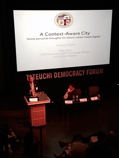
 The technologies drawing attention are user-centric that allow both users and providers to interact and share information about the transportation network. Active transportation and Safe Routes to Schools advocates should care about these trends because they are expanding transportation options, promoting active lifestyles and tipping the political scales towards multi-modalism in planning and implementation.The digital space is using the influx of information (i.e. big data) to find patterns and efficiencies in the transportation system. These mobile and web applications are facilitating supportive programs and policies for walking, bicycling and Safe Routes to School, even when active transportation is not the immediate focus of mobile and web applications. Safe Routes to School supporters will be able to better partner with transportation agencies, organizations and advocates, if they stay alert to the culture changes that technology is causing within transportation.
First, I posit that ride and car-sharing services will bolster walkable and bikeable communities. I see many ways that students and families will be supported and encouraged to be car-free or car-limited with more reliable alternative networks, such as ride and car-share, cross jurisdictional bicycle and pedestrian networks and public transportation. Ridesharing mobile applications like Uber, Lyft, and Sidecar are booming and flipped the script on taxi and car services and local job creation. Users of ride share applications can name their price for trips with Lyft and benefit (or suffer) with surge pricing with Uber. Potentially communities benefits in the strengthening of ride and car-share through crowdsourcing affordability and flexibility. Paratransit riders - usually the elderly and persons with disability - are also frequent users of ride-shares. Additionally, car sharing companies like Zipcar allow drivers to rent a car by the hour, where prices include insurance and maintenance. Personally, I know families that would benefit from having better access to alternative networks to get children to school and after-school activities. One family in particular was forced to give up their car free lifestyle when the local Zipcar location was closed. These technologies are means to fill in the transportation gaps for communities and families.
At the same time, communication between public transportation users and agencies are improving with technology at a low cost. This is important in Safe Route to School and student mobility policies because a growing number of schools are not longer able to support Big Yellow school bus services. In all built environment contexts, better informed public transit riders will perceive the system to be more reliable. Schools in cities are leveraging public bus and rail to get students to school. Rural communities are able to create Safe Routes to bus stops and within transit limited communities, parents will even take school buses with students to get to work. These are opportunities to leverage public transit for all segments of the community. With low cost technology, agencies are able to get schedules, updates and delays to customers more quickly and even real time, both through mobile smart phones and dial in services. For example, in Los Angeles County’s bus and rail operator, LA Metro, noted that 71% of its bus riders and 85% rail riders own a cell phone, most of which are smart phones. Real time communications could build better public participation and assess the needs of all users.
Public transportation technology complements the goals of Safe Routes to School and help students, young adults and parents develop lifelong healthy living skills. Free and discounted student public transit passes are a cornerstone for student mobility, which intrinsically forwards Safe Routes to School goals and increases physical activity. American Journal of Public Health 2013.
Lastly, transportation technology enable schools and transportation agencies to collect better data for trips to and from school. Orrenmaa Elementary School in the City of Riverside uses scanners to log students walking and bicycling to school, instead of tallying this information by hand. The Fire Up Your Feet program engages schools, students and parents on one website to build resources for schools and their communities, while tallying and measuring their physical activity. Transportation agencies can partner with mobile applications to collect data about users and the transportation network, such as travel by mode, number of trips and routes. Currently, there is no comprehensive data source for trips by bicycle and walking and mode share, especially to and from school.The American Community Survey (ACS) and Census only counts trips to work and the National Household Travel Survey (NHTS) will only provides additional information, if purchased by the state. California purchased an add-on for the state and school trips for NHTS 2009 and 2012, check your state's survey status at the NHTS website. Parents access transportation networks more often but are under counted. Technology is a way to get more data on trips to and from school and travel by mode to substantiate Safe Routes to School programs and policies.

